Thursday, 24 September 2015

E CAPANNELLE TO ASINAU

BERTRAUD AT GITE U RENOSU AT E CAPANNELLE
BIG BLACK PIG
CLOUD INVERSION FROM REFUGE DE PRATI
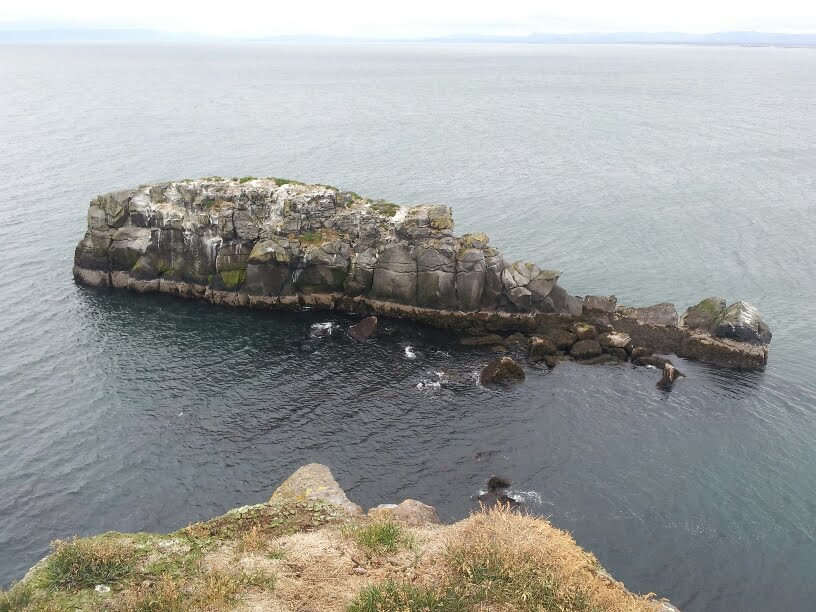
ROCKY WALKING FROM PRATI
IDO HAD THE SAME RUCKSACK AS ME
DEPARTURE FROM REFUGE D'USCIOLU
I WUZ 'ERE (BUT CAN'T REMEBER WHERE)
KIRK & GARRY, FIT AMERICANS WITH A TOTAL AGE OF AROUND 140 YEARS
It was windy again overnight, but I was well sheltered by the snow plough. I packed my tent and walked to the Gite for a morning coffee. From the terrace I could see a beautiful cloud inversion to the east. Bertraud and I left the Gite and started walking in that direction.

Once again, the path was relatively easy compared to those I had encountered in the north. Bertraud and I enjoyed a steady woodland walk for about three and a half hours until we reached the plateau du Ghalgone, where we stopped at a refuge hut for a brief rest and a drink - a cup of tea for me.

We proceded down a long valley towards Bocca de Verde, with me walking some distance ahead. I suddenly spotted a wild boar, or sanglier, next to the path. I made noises to ensure it had heard me, but it simply ignored me and got on with its own business as I walked past. Maybe it was just a big black pig and I am exagerating a bit.

Bertraud would be staying at the Refuge de Bocca Verde whereas I just had a late lunch there. We exchanged email addresses and I said goodbye as I continued on to my campsite at the Refuge de Prati. This would involve a climb of just over 500m - yes, that really is half a kilometer - which seemed pretty daunting last thing in the afternoon. I managed it in 2 hours.

The Refuge looked down on the east coast of Corsica, and I could clearly see the towns and villages. At last I was begining to sense that the end of the GR20 journey was near. There were still a few days to go, but I guessed that much of the remaining walking would be accompanied by views of the sea.

I pitched my tent behind a large rock, which seemed to do the job of protecting me from the wind. Shortly after the light faded someone patted the side of my tent and called out something. When I opened the zipper to investigate it turned out to be a girl from the Refuge come to collect the €7 camping fee I had forgotten to pay.

In the morning there was an even better cloud inversion to the east than I had seen on the previous morning. Indeed, it was so good that I didn't get to see the sea all day. So much for my earlier prediction! However, the views to the west were clear.

After two relatively easy days, I had assumed that the walking would be much more gentle all the way to the end of the trail at Conca. I was wrong! The day's walk was tough and rocky, and involved climbing to the summit of Punta Della Capella (2,041m), then down to Bocca Lapiro (1,525m), then up to Monte Formicola (1,981m) before finally coming down to the Refuge d'Usciolu at 1,727m. It was an exhausting day on difficult paths, made even harder by the 30+ degree Celsius temperatures. I had drunk almost all my 2 litres of water by the time I arrived at the Refuge.

The late afternoon was spent chatting to Adrienne, who had already been at Uscioli for a while having set off from Prati very early, and new acquaintance Ido, from Israel. Ido had chosen the same design of rucksack as me and was interested in my experiences with it. I wondered if my lack of energy today was due to insufficient food, so in the early evening I ate the Refuge's hearty pasta supper with Americans Garry and Kirk, who generously shared their wine. We didn't stay up very late as it was getting cold.

I decided to use one of the ready-pitched tents this evening rather than my own because they had nice thick comfortable sleeping pads inside, in contrast to my own rather thin one. I wanted a good night's sleep as the following day I would be doing 2 consecutive stages, which would take me in excess of 8 hours.

I was away by 8.10am and for the next two hours had to tackle a long rocky mountain ridge at about 1,800m. Clouds obscured the easterly view again, but to the west, right at the foot of the mountain, many small villages could be seen and further away, the west coast. Descending the southern end of the ridge to a place called Bocca di l'Agnonu, I came to a choice of paths. One path led directly to the Refuge d'Asinau, my intended destination, along the old GR20 route. The other was the new GR20 route comprising two stages, the first to Refuge d'A Matalza and the next from Refuge d'A Matalza to Refuge d'Asinau. I had already decided that I would do both stages of the new route, partly because I had the maps for it and partly because I knew the several GR20 acquaintances would be on this route, but not necessarily doing both stages, so it would be chance to say farewell. So it was the case with Garry and Kirk, who I left at the Bergeries de Bassetta eating omelettes and drinking Orangina.

The path to Bassetta and on to Matalza and beyond was easy, and didn't get rocky until I started to climb Monte Incudine. The steep descent from the mountain ridge down to the Refuge d'Asinau was quite difficult though, but in spite of having been walking for over 9 hours, including breaks, I was still feeling positively energised.

Having pitched my tent, I was starting to think about food when one of a group of four Belgian lads I had spoken to frequently on the trek offered to boil me up some water to hydrate the meal Tom had given me in Vizzavona. It was a very tasty and filling curry, so thanks Tom. In return, I was able to share some of my tea and coffee. Afterwards I chatted to Ido for a while before it got cold and we retired to our respective sleeping bags. Ido was planning to do another two stages tomorrow so I might not see him again.

Wednesday, 23 September 2015

MANGANU TO E CAPANNELLE

SPOOKY ASCENT TO BRECHE DE CAPITELLO
LAC DE RINOSO
FRIENDLY BEASTS, FAR TOO CHILLED TO THREATEN ANYONE
BOCCA MUZZELLA AT 2,210 METRES
ONE OF MANY LIZARDS
WALKING COMPANIONS, WITH TOM AT FRONT RIGHT
DISCARDED BOOTS AT VIZZAVONA RAILWAY STATION
CAN'T GET MUCH MORE SECURE THAN TYING YOUR TENT TO A SNOWPLOUGH
It was now Monday the 14th, and according to my guide, today I would be hiking the 7th stage of the trail, taking me from the Refuge de Manganu to the Refuge de Petra Piana. A study of the map suggested that I would be on steep rocky terrain again, and this certainly turned out to be the case.

It had been windy overnight - indeed Neil and Josie's tent had almost blown down in the small hours - and that wind persisted throughout the day.

The final ingredient of the day's weather was the fog, which was dense and persistent throughout the morning. It made the climb up to Breche de Capitello seem quite spooky. Working along the ridge from there was hard work with lots of rock obstacles to climb over. Far below me were Lac de Capitello and, later, Lac de Melo and Lac de Rinoso. On the climb up to Col de Rinoso I came across two girls unable to proceed because there was a horned cow on the path. I did the gentlemanly thing and pushed it away with my trekking poles so we could all continue. When I did reach the Col de Rinosa I found Neil and Josie just starting lunch, so I joined them and we shared food again. We were briefly joined by yet another two Belgians, Rob and Marie, who were most impressed with my peanut butter, which they had not tried before.

The final part of the day's walk was a rocky downhill stretch to the Refuge de Petra Piana. The Refuge was beautifully located to enjoy the magnificent mountain views now that the fog had cleared.

After I had pitched my tent I had a job to do for Rob. The sole of one of his boots was starting to detatch from the upper, a problem that I'd had earlier on the trail. He'd seen how successfully I had repaired my own footwear and asked if I could do the same for him. I duly obliged.

There was a choice of routes the following day. The regular route involved descending 800m down a valley, and then having to climb 500m up again to the next Refuge de l'Onda. The alternative route stuck to the high ground and included a bit of ridge scrambling, which seemed wholly more attractive. Which route to take depended mainly on the weather.

By the time I had retired to my tent for the night, the strong winds of the previous night had already returned. As darkness fell the winds got stronger until the tent was writhing and buckling under the pressure. It is difficult to get much sleep when you are worried that your flimsy canvas protection might let you down at any moment. As it happened, the tent held together, although one end went slack because a guy rope had dragged the rock it was attached to. Other campers were not so lucky and spent the night having to re-peg their fragile abodes.

The wind was still blowing hard in the morning, which made packing the tent away difficult. I asked Tom whether he thought the high route was still feasible. His view was that the severity of the wind was partly due to the location of the campsite, and that there was a good chance that it would be safe on the hills. He was right. Whilst it was still blowy, the wind wasn't severe and the walk to Refuge de l'Onda was enjoyable and not particularly strenuous.

It was only 11.30am when I reached the refuge, which was too early to stop, so I decided that I would continue onto Vizzavona. However, leaving right away would mean that I would not be able to say a proper farewell to some of the friends I had made along the way, including Neil and Josie, and Rob and Marie. I had some lunch, filled my water bottles, checked my maps and generally fussed around for a bit, hoping they might arrive.

It was not to be. Getting to Vizzavona would take 6 hours, so by 12.30pm I had to leave. Neil and Josie have my email address anyway, so I guess we might be in contact later. The departure from l'Onda involved another steep climb and it took me over 2 hours to reach the summit of Punta Miratella at 2,141m. The walk down from there was rocky and difficult, and I was particilarly careful not to have another fall. The descent seemed endless and often involved walking across huge rock slabs pitched at an angle and relying on boot friction to walk across. Lizards seemed to enjoy basking on these slabs and scurried away as I aproached. Eventually the path improved and I started to come across people out for a casual country stroll, which meant I must be close to a populated area. Finally, I reached the road and walked to la gare de Vizzavona (the railway station, where many people join and leave the trail).

I passed the campsite and found the 'Bar-Restaurant la Gare de Vizzavona', a Gite d'etape where I booked demi-pension. Sitting on a table outside with several other faces I recognised from the trail was Tom, who had also decided to do a double stage. He would be going home from this point and was pleased to see me before he went. Apparently, he had scratched 'Go, Steve, Go' across the path to encourage me, but I hadn't seen the message and it would probably have been obliterated by the footfall of others anyway. He kindly gave me his last packet of camping food as he no longer needed it.

The Gite was not the nicest place I had stayed at and the landlord/owner seemed bad tempered. I shared supper with Bertraud from Lyon, France, who was in the same dorm. He had arrived today and asked if he could walk with me in the morning.

At least the breakfast at the Gite was good. Whilst waiting outside to commence Wednesday's walk, I found an old pair of discarded boots left by the railway platform. I had been told that the GR20 destroys boots and this was not unusual.

The walk from Vizzavona to E Capannelle was the easiest yet, with generally good paths and modest climbing. Bertraud was two years younger than me, but had not been well in the past, and struggled a bit to keep up. Nevertheless, we still made good time and, at Bertraud's suggestion, headed for the Gite u Renosu at E Capannelle rather than the Refuge. This was a good move as the camping was cheaper, they had a hot showers and the food was excellent. They also had electrical power so I could charge my electronics and keep writing the blog (but still no WiFi).

Another benefit of the Gite was that few other hikers seemed be aware of it. The only other GR20'er was Adrienne, from Australia, who had set off from Calenzana the day before I did. We compared trail notes over drinks on the terrace, and the Gite owner thoughtfully brought us a plate of olives and charcuterie.

E Capennelle is a ski resort in the winter and I pitched my tent between a hut and a snow plough to give it some shelter from the wind, tying one of my guy ropes to its track. I didn't think a snow plough would get dragged in the wind.

Tuesday, 22 September 2015

ASCU-STAGNU TO MANGANU

THE ROUTE TO MONTE CINTU
CALL THIS AS FOOTPATH?
MONTE CINTU SUMMIT
MIST AT 2,700 METRES
WALKING COMPANIONS AT AUBERGE U VALLONE
THIS IS HOW THEY GET SUPPLIES UP TO THE REFUGES
BELGIAN TOM AT GITE DE VERGIO
LAC DE NINO
According to my guide, the next stage of the GR20 is from Refuge d'Ascu-Stagnu to Refuge de Tighjettu via a place called the 'Cirque de la Solitude', reputed to be a particularly tricky part of the GR20 to traverse. Unfortunately, I would not get the chance to try it because of a disaster which occured at the Cirque in June of this year. As a result of heavy rainfall there was a rock-slide and at least 4 people were killed and double that number injured. The rocks are still considered unstable so the route through the Cirque, and consequently the whole of the stage, has been closed.

Fortunately an alternative route has been devised, but it takes two hours longer and is even tougher because it passes close to Monte Cintu, the highest mountain in Corsica. For those who didn't fancy the alternative route, there was a bus organised to bypass it - for €35.

Thus, you can interpret my decision to take the alternative route as either meaness or a determination not to leave a gap in my GR20 journey. Whatever, I set off at about 8.30am and followed the two yellow stripes that had been painted onto rocks and trees to help guide us. The path was pretty easy at first, but then it got steeper and steeper. A lot of climbing was needed as I worked my way up the Cirque de Trimbolacciu until I eventually reached Bocca Pampanosa at about 2,500m.

A large number of rucksacks had been left by a stone shelter at the col, but I knew what they were for. Walkers had temporarily discarded their heavy kit to take a brief detour up to Monte Cintu, 2,710m high and about 2 hours round trip from this point. Visiting Corsica's highest mountain was too good an opportunity to miss, so I left my rucksack with the others and did the same.

Reaching the summit involved a bit of rock scrambling, but this was easy without a full pack. I am told that the whole of the island can be seen from here on a clear day but, unfortunately, my climb was accompanied by mist. At the top was a Corsican flag and a tin box containing a book for visitors to sign. I couldn't find a pen so I stuck a business card in there instead. You never know. A low flying aircraft might pick it up!

My rucksack was the only one left by the time I got back to collect it at around 3.00pm. The higher you go, the longer the descent is, so I now had a long slow trudge down to the hostel. I had skipped lunch to save time and although I had been nibbling sugary sweets for energy (don't tell the dentist), I was getting tired. We all know the pride comes before a fall, so I shouldn't have been so pleased with myself at reaching the summit as the next bit was inevitable. I slipped on a rock and knocked my knee. It hurt, but thankfully not enough to tell me that I had done any real damage, and I had not broken the skin. Previous experience has taught me that the best cure for such an injury is to keep moving, so I carefully limped the rest of the way down to the Refuge de Tighjettu.

As I approached the Refuge I met a girl hiker leaving the place who told me that it was very overcrowded, but if I continued walking for another half hour I would find a much more pleasant place. I took her advice and soon reached the Auberge u Vallone, where I came across a group of other GR20 walkers who I'd met at the other refuges. They told me to pull up a chair and share some goat's cheese, spiced sausage and beer with them. It was a pleasant end to a full 9 hours of walking. I hoped my knee would be good for the following day.

Living in a small tent with a painful knee is hard, as doing most things involves kneeling. Still, I coped, and the following morning I managed to get myself ready to depart by 8.30pm. My knee felt much as it had the night before, which I considered good news as it hadn't got any worse.

The next stage would get me to Refuge de Ciottila de Mori in 3 to 4 hours - a short day, but perhaps an ideal duration under the circumstances. The route involved a couple of hours of easy walking down a wooded valley, and then some steady climbing up to la Bocca di Fuciale at 1,962m. From there it was just another half kilometer to the Refuge de Ciottila de Mori where I stopped to eat and drink. I considered pitching my tent as planned, but the weather was beautiful, my knee felt better and and it seemed too early to stop.

Thus, I left the refuge and continued along the GR20 route, knowing that there were a couple of other refuges further on. The terrain was roughly similar to that found in the UK, with rolling hills and gently sloping woodland paths. I was able to move much more quickly than before, and when I reached the Bergerie de Radule, a potential camping place, it was still only 3.00pm, so I kept walking. An hour later I reached the Gite de Vergio which offered demi-pension (evening meal, a bed in a dorm and breakfast) for €48. The thought of a comfortable mattress was too tempting to pass up. There was a campsite too with some rather tame pigs wandering around it foraging for fir cones. Tom was there in his tent and we both agreed that it had been well worth the extra walking to get here.

After enjoying the best hot shower I'd had for days, I felt clean again. I had dinner with Australians Jamie and Paula, and managed to get my blog writing up to date, although I still couldn't post anything as there was no WiFi (Again? When are these Corsican establishments going to get up to date!).

After a restful night, I woke up to find it raining for the first time, with dark clouds overhead and the sound of a thunderstorm in the distance. Staying in the dorm had been a fortunate decision as I didn't have a wet tent to pack away.  I discussed the weather situation with other walkers and we all agreed that we would wait a while to see if things improved. Sure enough, by 9.00am it was clearing and an hour later I was off.

The day's walk was largely on good paths with only a few rocky bits to traverse, none of which required the use of hands. The ascent was about 480m up to Bocca a Reta, but this was over a period of nearly 3 hours of walking, so the gradient was low. I had my lunch about a kilometer east of the Bocca by the waters of Lac de Nino.

I noticed that the GR20 route marked on the ground was different to what the map said for the next two kilometers, and later realised that this was to ensure that walkers passed a place selling refreshments and cheese. I wondered if money had changed hands to get that done. I finally reached the Refuge de Manganu at about 4.00pm, and pitched my tent.

It had been a lovely walking day, alternating between sun and clouds, and although rain threatened at times, it never actually materialised. I decided not to take the evening meal at the Refuge this evening as I was getting bored with pasta. The Guardian cooked me an onion omelette to eat instead, after which I withdrew to my tent for an early night.

Monday, 21 September 2015

CALVI & CALENZANA TO ASCU-STAGNU

MY TRAIN AT BASTIA STATION
CALVI
CAMPSITE AT THE GITE D'ETAPE IN CALENZANA
LEMON SORBET IN VODKA
LOOKING BACK TOWARDS CALVI
IMPRESSIVE MOUNTAINS
SPAIMATA SUSPENSION BRIDGE
LOVELY BELGIAN COUPLE NEIL AND JOSIE
The train left Bastia for Calvi at 9.25am. Most of the other passengers looked like hikers. We were all in for a treat.

Once out of the environs of Bastia, the train wove through river valleys and over bridges, giving us spectacular views of the rugged mountains. They looked beautiful, but intimidating; I decided to put the latter characteristic to the back of my mind for now. The journey only cost €16.40 but if they had called it a scenic railway trip and charged twice the price, I'm sure they would have filled all the seats.

The half-way point of the journey was Pont Leccia, where we waited for passengers from the Ajaccio train to come aboard. It was then a slow winding descent to the coast near I'lle Rousse. The final part of the rail trip followed the shore-line into Calvi and was just as breathtaking as the mountain section. When we rolled into Calvi at 12.47pm I wondered how over 3 hours could go so quickly.

I could have alighted a few miles before Calvi at a campsite for GR20'ers, but it would have been a shame not to pay a visit to this pretty harbour town, and it was too late in the day to start the walk anyway. Like Bastia, Calvi had an overlooking citadel, which I obviously explored. It also had a large marina filled with expensive yachts and a promenade lined with bars and restaurants offering their 'Menu du Jour'. I ended up buying lunch from local Spar store though (Spar seems to be popular in Corsica).

My intention was to start the GR20 tomorrow and that required me to get to the start point in the village of Calenzana, about 9 miles away, before nightfall. At a push I could have walked along the roadside, but I found a private bus company that would take me, along with quite a few others, to Calenzana for just €8 each. I noted that the thermometer above the windscreen said the outside temperature was 31 degrees C. 

We were dropped off outside the Calenzana Gite d'etape at about 4.30pm. All the rooms were booked but I paid to pitch my tent nearby. On the rocky ground, this required the use of the masonry nails I had brought as tent pegs.

I explored the village, which was slightly dilapidated but still a really pretty place with loads of character. Residents were sitting on their doorsteps smoking, chatting and enjoying the late afternoon sun.

I located the start of the GR20 path to save me looking for it next morning, and then ordered supper from the Restaurant Le Calenzena. It was only pizza, but it tasted good, and it was followed by a sweet of 'Citron Sorbet in Vodka'. Cracking. Along with a half litre of Corsican red wine, I knew I would sleep well. When I came to pay the bill they also gave me a free glass of a Corsican liqueur called 'Red Myrtle' which was served ice-cold. It is apparently distilled from Corsican myrtles harvested in the shrublands (the maquis). I was pleased that the campsite was downhill from the restaurant so I could roll in the correct direction.

I awoke as the sun rose with a clear head, surprisingly, and on exiting my tent found that many of those that surounded mine the previous evening had now gone - the early starters, who were either concerned about storms breaking in the afternoon or simply wanted to chose the best tent pitch at the Refuge d'Ortu di u Piobbu, the next stopping point some 6 to 7 hours of walking away. I left the Gite at 8.00am so there was still plenty of time.

This first stage of the GR20 involved an ascent of 1,360m and I knew that it would be a hard plod with a full rucksack. The path was clearly marked with the usual red and white stripes of a GR trail, but it was rocky so concentration was required to avoid tripping over. From time to time I would look back at Calvi receeding into the distance. The view was especially good from the col at Bocca a u Saltu at 1,250m.

The next hour of the trail was steep, and hands as well as feet were required to make progress, so the trekking poles were stowed away. It was tiring work for the first day, so I was pleased to reach the grassy col at Bocca a u Bazzichellu at 1.00pm, which was the perfect time to have my lunch of cheese and salami on pitta bread.

The final part of the walk to Piobbu Refuge took me a little over an hour. The early starters had been there a while and the place was buzzing with activity with people busily pitching their tents. The Refuge was pretty basic with only cold spring water for washing, but for €20 they offered a hot evening meal which comprised vegetable soup for starters, lentils with sausage for the main course, and cake for afters. It wasn't the most generous meal, though, as it was a challenge to find the sausage.

It was cool the following morning because the Refuge was at 1,450m and shaded by the steep mountains. I was away by 8.20am and continued south climbing through woods on rocky paths. Progress slowed considerably as I left the woods and the rocks became boulderfields. This was tough going, and when I reached the Bocca di Pisciaghja at 11.30am I thought the hard work was over. In fact, it was just beginning.

I should have guessed this as I surveyed the terrain to the south. It was the most rugged I had ever seen, with steep mountain ridges, one after another, separated by deep, almost bottomless, valleys. The mountains were topped by sharp pinnacles that I would later discover the GR20 path weaves around. It was difficult to see where they could find places flat enough to build a refuge.

The next hour involved scrambling up and down jagged rocks. At the Bocca d'Avartoli I stopped for lunch, sharing food with a young Belgian couple, Neil and Josie, who I had first met whilst waiting for the bus at Calvi.

There was one more col to reach after lunch, Bocca di L'Innominata, and then it was an hour and a half of descending down slippery scree. The Refuge de Carrozzu finally appeared from amongst the trees. After a full-on 7 hour day, I was pleased to pitch my tent, have a cold shower and enjoy the evening meal in the pleasant company of fellow hikers.

Other than the early crossing of a swaying suspension bridge at Spasimata, the third day of walking was much as the second day, with rugged paths, boulderfields, scrambling up and down rock faces, often with protective chains attached,  and sliding down steep scree slopes. What made it easier was that I now knew what to expect and I could feel myself getting stronger. I once again shared some lunch with Neil and Josie on the Bocca di Stagnu before descending to the Refuge d'Ascu-Stagnu.

There is a tarmac road leading to this refuge, so many visitors come here just for the day. They are easily distinguished from the GR20 hikers by the small rucksacks they carry. The refuge had electricity to charge phones and cameras, but no WiFi sadly. It also had food to purchase for the trail and a separate restaurant that served an a la carte menu and took credit cards. I took full advantage of all that was available and enjoyed a fine steak meal with Tom, another Belgian, who was also walking the trail alone and with whom I shared a table. We had many interests in common and got along very well.

The next day's walk would take me past Corsica's highest mountain, but more about that in the next post. 

Sunday, 6 September 2015

BASTIA, CORSICA

OUT WITH ANDY'S CYCLING PALS
BASTIA, CORSICA'S SECOND LARGES CITY
MY BUDGET HOTEL IN BASTIA
BASTIA HARBOUR
COLOURFUL CAR FERRY
It's Sunday the 6th of September and I am lying on the bed in my hotel room in Bastia, Corsica.

I have barely come up for air since Iceland. Within days of my return I was visiting grandchildren Isaac and Susanna near Lewes. I then spent a week at the Long Mynd Hotel at Church Stretton guiding walks for HF Holiday guests. That was immediately followed by a long weekend in Dartmouth with Rubi, watching the annual Regatta. Now, just six days later, I am here in Corsica! In between all this I did manage to do some paid work.

I admit that I had been feeling rather weary lately,  but I am convinced that three weeks of walking in the Corsican mountains with a weighty rucksack will soon fix that (?).

Walks like this demand special care when deciding what to bring, since everything has to be carried the full distance. I ummed and ahhed greatly when it came to the weight versus comfort compromises, e.g. do I bring the cosy thick heavy sleeping bag or the cold thin light one?

The packing process was sufficiently well advanced to squeeze in a 22 mile cycle ride with neighbour Andy and friends yesterday morning. The reward for our effort was an 'elevenses' comprising a Bloody Mary with nibbles at Andy's holiday home on the Solent.

The Easyjet flight to Bastia Airport was scheduled to leave Gatwick at 6.10am this morning. Normally, such an early departure would have required me to travel up on the preceding evening but Rubi offered to drive me there. An angel in disguise to be sure.

We left for Gatwick at around 2.45am and the journey would have been straightforward had I not managed to create confusion about the quickest way to reach the A3 from my house; then we found that the exit from the A3 onto the M25 eastbound carraigeway had been closed due to road works. What diversion signs there were seemed to send us around in circles. Time was ticking away when we finally worked out that we were meant to exit onto the M25 westbound carraigeway and then turn round onto the eastbound carraigeway at the next junction (which, incidentally, was 6 miles away). For a while we both wondered if I would miss the plane, but neither of us said anything until I had finally checked my baggage in. Phew!

After fond farewells I was off, and a few hours later I was on French soil. It was certainly a lot warmer than English soil. From this point on I had made no plans whatsoever, so I asked at the Information Desk at Bastia Airport how to get to Calvi, the coastal town nearest to the northern end of the GR20. They told me to take the Airport bus to Bastia centre and from there catch the 16.44 train which would get me to Calvi at 20.00.

Bastia is a busy ferry port and the second largest city in Corsica after Ajacco. The name, Bastia, derives from the bastion built by the Genoese to provide shelter from sea storms and about which the town grew. As soon as I stepped off the bus I realised that Bastia is an interesting place and I should use the rest of the day to explore it and catch the train in the morning. After all, who wants to arrive somewhere unfamiliar like Calvi at 8.00 in the evening and then have to look for accommodation.

With a  little help from the Tourist Office, I found the 'basic but cheap' Hotel Le Forum, with its crumbling exterior and tired interior. At €30 per night I wasn't complaining though. Hence, here I am now, having enjoyed a nice sunny afternoon exploring Bastia, blogging away and looking forward to my mountain railway journey to Calvi tomorrow.

Tuesday, 11 August 2015

LAST THINGS

THINGVELLIR NATIONAL PARK
GULLFOSS
STROKKUR GUSHES


MUD POT AT SELTUN
BLUE LAGOON

MY B&B IN KEFLAVIK
FISHING BOATS BEING MAINTAINED AT KEFLAVIK
COASTGUARD VESSEL NEAR KEFLAVIK
AMAZING WHALE-SHAPED ISLAND NEAR KEVLAVIK
HOLMSBERGSVITI LIGHTHOUSE
It's Saturday and I have all day to drive to Reykjavik. If I drove directly I would be there in about 3 hours, so I decided to take an indirect route.

A popular tourist route that comprises a large loop from Reykjavik to central Iceland and back, involving about 190 miles of driving, is called the Golden Circle. It includes stops at Thingvellir National Park, the waterfall Gullfoss (meaning Golden Falls) and the geysers Geysir and Strokkur at the geothermally active area Haikadalur.

I must admit to being a bit sniffy about doing this rather 'touristy' thing, which is why I left it until last and 'only if I had time'. However, my arrival at Thingvellir soon persuaded me that my attitude had been misplaced.

The National Park lies in a rift valley that marks the crest of the Mid-Atlantic Ridge. It is at the northern end of Thingvallavatn, the largest natural lake in Iceland.

The historical significance is that the Icelandic Parliament, called the Althing, was founded here in 930AD and remained here until 1798. The National Park was established in 1930 to mark the 1,000th anniversary of the Althing. The Park is also an incredibly interesting and beautiful place, geologically, and I enjoyed a good long walk through it.

I next proceeded to Gullfoss. In spite of  waterfalls being rather commonplace in Iceland, this one was rather special as it is effectively two waterfalls in one. The photo shows this more clearly than can be described in words.

Finally, I drove to see the geysers. The most famous one, Geysir, from which the name of the phenomenon is derived, has been inactive for many years but Strokkur erupts at 5-10 minute intervals. Everyone was standing around it with their cameras at the ready. It teased us, bubbling and gurgling and looking like it might erupt, and then not doing so. Then it would spout almost without warning. It was as if it was playing a game with us.

The early evening drive back to the Bus Hostel in Reykjavik was pleasant, and I booked in for my fifth night.

My stay was brief. Checking-out again in the morning, it was time to say a last farewell to the city. The plan for the day was to explore the Reykjanes peninsula. This had looked like an interesting place from the very beginning, but it made sense to leave it until last because the Airport was near the end of the peninsula.

It was sunny as I headed west out of Reykjavik on Route 41, then turned south on Route 42. Within 30 minutes of leaving the hostel I was amongst the debris of huge past volcanic activity and the manifestations of the present geothermal activity. The landscape near Kleifarvatn lake was stunning and I stopped to photograph the streaming vents and boiling mud-pots at Seltun.

I reached Route 427 along the south of the peninsula and continued westwards to Grindavik. From here it was a short drive to the Blue Lagoon, a geothermal spa much like Myvatn Naturebath. Like the highlighted locations on the Golden Circle, this is another place that tourists are almost compelled to visit. It is impressive, with waters an almost unreal milky blue colour due to the high mineral content. However, bathing there is twice the price of Myvatn and, since I had already been to the latter, I didn't go in - not that I had the time anyway.

Keeping close to the coast, I came to the Reykjanesvirkjun geothermal power station near the tip of the peninsula at Reykanes. Inside was an exhibition called 'Power Plant Earth' about geothermal energy. Whilst looking at the displays, the attendant told me he was feeling unwell and had to go to the hospital, so could I let myself out when I had finished.

When I had, I carried on around the end of the peninsula, recalling that this was the 'moonlike' landscape that I had seen from the aircraft when I came in to land on arrival. Close-to now, it still looked lunar.

I finally drove into Keflavik to find my B&B in the town centre, and was greeted by the owners, Renata and Pauli. I had given myself enough time to check-in and empty the car of my belongings before the man from the car hire company came to pick it up. I had driven 1,650 miles in eight days, an average of just over 200 miles per day.

Relieved of four-wheeled transport, I used my legs to take me for a two hour walk along Keflavik promenade. It was a clean, quiet, pleasant town and I particularly enjoyed looking around the harbour areas. I also noted an Irish pub selling Guinness in the town, but then remembered that many Icelanders had Irish roots. There was little more that I could have seen in Reykjavik so it had been a good decision to come here. I spent the evening packing my bags for tomorrow's flight home.

Renata and Pauli's B&B was a cut-above the hostels where I had been staying. For instance, they provided bedding instead of me having to use my sleeping bag, and the breakfast was supurb. I didn't have to get to the airport until the afternoon so decided to head out on another walk. Renata told me that there was no need to vacate the room until I was ready.

My walk was along the clifftops to the north in the general direction of Gardur. There was a path to begin with, but this soon petered out. This was obviously a place where seabirds lay their eggs because I was regularly being harried by Gulls and Terns. I was told that they can cause significant injury if they attack, so I put my rucksack on my head if they started swooping too close. I passed a small rocky island that looked like a whale and then reached the orange-painted Holmsbergsviti lighthouse I decided it was time to turn back when I reached a golf course that extended right to the cliff edge - I wondered how many balls end up in the sea.

By the time I got back to the B&B I had been out for four hours and walked about 10 miles. Renata's daughter drove me to the airport. On the way, she asked me what had been my favourite bit of Iceland. I struggled a bit to answer because there had been so many outstanding moments, but eventually concluded that it was the final day's walk on the Laugavegur trail from Alftavatn to Landmannalaugar.

I felt I had used my time well and gained a good appreciation of this wonderful country. However, I now needed a holiday before my September expedition to Corsica, so I was quite looking forward to relaxing at home for a bit.

Saturday, 8 August 2015

NORTH ICELAND

BASALT COLUMNS AT HOFSOS
TURF ROOF AT SIGLUFJORDUR
SIGLUFJORDUR FROM OVERLOOKING HILL
THE RED TRAFFIC LIGHTS IN AKUREYRI SAY 'I LOVE YOU'
ROCK PILLAR AT MYVATN
VIEW FROM MYVATN NATUREBATH
VIEW OF MYVATN FROM TOP OF VINDBELGJARFJALL
GODAFOSS
I woke at the Broddanes hostel at 6.00am and proceeded to tuck into a breakfast of Chocolate Weetos (from the free cupboard) and banana (which I had brought), with Coffee Mate as a substitute for milk. Though still overcast, the weather had calmed and I watched the Arctic Terns wheeling and cavorting while I ate. I noticed how their fan-tails spread when flying slowly or hovering, but sleeked back when they were flying fast. I remembered that one had kept pace with me the other day as I crossed a bridge at 50mph.

By 7.30am I was off, out of the Westfjords and heading south to join Route 1. 

Just in case this isn't clear already, Route 1 is Iceland's main highway, and it goes all the way around the island in a big distorted circle. It's  bit like the M25 London Orbital, only bigger, and whereas the Orbital encloses an area with a huge population, much of the area enclosed by Route 1 is either volcanic wasteland, including lavafields and glaciers, or areas uninhabitable for much of the year because of the harsh climate.

Anyway, I turned left, meaning that I was now travelling clockwise around Route 1. What immediately struck me was the lack of cars. Here was I on the county's main highway during the rush hour, and most of the time it was empty. I wish the M25 was like this.

It was quite foggy, so there was little to see, but progress on Route 1 was much more rapid than driving around the Westfjords because the roads are straighter. After a couple of hours I turned right onto Route 76. This would take me to my hostel at Siglufjordur at the end of the Trollaskagi peninisula, otherwise known as the Troll peninsula. Along the way I wanted to visit Hofsos.

Hofsos is a pretty fishing village with a population of about 200. However, what particularly interested me was the coastal rock formations. When thick layers of basalt lava cool rapidly, the resulting contraction can cause vertical fractures to appear in such a way that polygonal columns are formed. I just had to see this and I was not disappointed.

Besides, this saves me a trip to see the Giant's Causeway in Northern Ireland, which is the result of the very same process.

I reached the Siglufjordur hostel at about 3.00pm, checked in, then went to explore. The town developed and reached its peak in the 1940's and 50's because of herring fishing. The herring are gone now and the population has fallen to around 1,200, but fishing remains a principal component of its economy. The town is a clean and attractive place, and I liked the cottage with a turf roof. I walked up the hill on the western side to get an aerial view and take some pictures of the boats and colourful buildings.

I shared my dorm with Chloe and Valerie, two young girls from Canada, who were spending nearly a month exploring Iceland. Their next stop was Akureyri, Iceland's second city, so when they heard that I was passing that way in the morning, they asked if I would give them a lift. Being a gentleman, I duly obliged. After dropping them close to the centre, I parked the car and had a quick look around. It was a nice enough place, though not worth a special trip unless intending to use it as a base for a walking holiday. One interesting thing is that the red light on all the local traffic lights is in the shape of a heart. Apparently, this was done to cheer people up and get them thinking positively after the 2008 financial crash. Also, the Visitor Centre did have some useful information about Myvatn, my next destination.

Myvatn is a lake that was formed a mere 2,300 years ago by huge volcanic activity. There are all manner of volcanic phenomena to be seen at the lake and in the surrounding area; craters, lavafields, signs of massive ground upheaval, pseudocraters caused by steam explosions, rock pillars and hot springs. The place is a vulcanologist's dream and a fascinating place for anyone to explore. 

I had two objectives for the day:

The first was to visit the Myvatn Naturebath, where I was able to enjoy a relaxing dip in geothermal water, rich in minerals, from 2.5 kilometres underground, whilst enjoying the view of the lake and surrounding mountains. It was most relaxing, and good for the skin I am told.

My second was to climb a volcano, and I chose the 529m Vindbelgjarfjall. I got to the top from the road in just 40 minutes, catching up with a few other people as I climbed. Once there, however, I found myself surrounded by swarms of midges, so I quickly took some pictures and made my way down even more rapidly. It was only later that I found out that Myvatn means Midge Lake!

Myvatn is as far east as I had intended to go in Iceland. Many visitors to the country drive around the whole of Route 1 in a week, but then miss out on the Westfjords which, in my view, is one of the best bits. I was happy that my itinerary had given me a really good appreciation of the many different flavours of Iceland.

It was now about 4.00pm and I had four hours of driving ahead of me to get to my next hostel at Saeberg, by Hrutafjordur. However, it would be easy-going on Route 1, anticlockwise this time, and at least I don't have to worry about it getting dark. Just as well as I had noticed that the car had lost a headlamp bulb. Since it is a legal requirement to drive with headlamps on, I used the front spotlamps as a substitute.

I did stop briefly at Godafoss (God's waterfall) along the way. It created a lovely display, but Iceland has so many lovely waterfalls that it is easy to get blase about them.

Reaching my hostel a Saeberg marked the end of my brief trip to North Iceland. Tomorrow I will be back at the Bus Hostel in Reykjavik.